A335, Southampton airport
Scene meta data
- Scene ID
- #28
- Measurement date
- 22 June 2014
- Category name
- (O - 17). Transport: Rail and roads
- Category description
Man made concrete or tar based sealings of the plain ground, such as roads, parking areas, airport runways, etc. 2014 update will replace the minimum width criteria of 25m with variable road widths based on grade of road, e.g. Motorway, A Road, local street etc. Large parking areas around business parks and retail sites fall in this category.
- Latitude
- 50.95015
- Longitude
- -1.36952
Scene previews
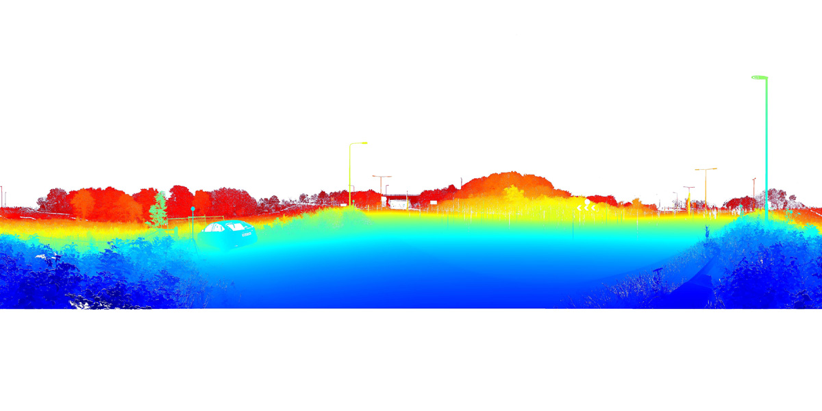
Pointcloud preview
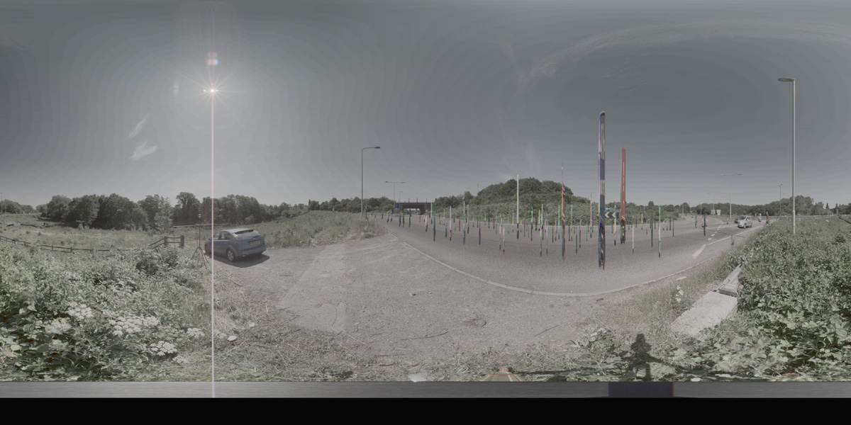
Panorama preview
Downloads
| Name | Kind | File size |
|---|---|---|
| O_17_28.txt | Info | 625.0 B |
| clean_cloud28_UPDATE.pcd_.zip | Pointcloud | 192.9 MB |
| rep1-27.hdr | Panorama | 40.8 MB |
| rep2-25.hdr | Panorama | 40.7 MB |
| scene28_small_rgb.csv | WebGL RGB | 2.8 MB |
| scene28_small_xyz.csv | WebGL XYZ | 7.2 MB |
| StereoNEF-22.zip | Stereo | 1,006.6 MB |
| ThumbNails-26.zip | Stereo | 17.2 MB |
| Scene28_Res600_900_Depth.zip | Stereo LiDar 600x900 Depth Maps | 21.8 MB |
| Scene28_Res600_900_Masks.zip | Stereo LiDar 600x900 Motion Masks | 342.9 KB |
| Scene28_Res600_900_StereoIm.zip | Stereo LiDar 600x900 Stereo Images | 39.1 MB |
| Scene28_Res688_1032_Depth-1.zip | Stereo LiDar 688x1032 Depth Maps | 26.9 MB |
| Scene28_Res688_1032_Masks.zip | Stereo LiDar 688x1032 Motion Masks | 1.4 MB |
| Scene28_Res688_1032_StereoIm.zip | Stereo LiDar 688x1032 Stereo Images | 51.6 MB |
| SYNS-Scene-28.zip | Combined ZIP | unknown |